جلد سخت سیاه و سفید
Product details
- Publisher : Apress; 1st ed. edition (July 21, 2022)
- Language : English
- Paperback : 327 pages
- ISBN-10 : 1484282868
- ISBN-13 : 978-1484282861
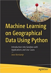
کتاب Machine Learning on Geographical Data Using Python: Introduction into Geodata with Applications and Use Cases
Get up and running with the basics of geographic information systems (GIS), geospatial analysis, and machine learning on spatial data in Python. This book starts with an introduction to geodata and covers topics such as GIS and common tools, standard formats of geographical data, and an overview of Python tools for geodata. Specifics and difficulties one may encounter when using geographical data are discussed: from coordinate systems and map projections to different geodata formats and types such as points, lines, polygons, and rasters. Analytics operations typically applied to geodata are explained such as clipping, intersecting, buffering, merging, dissolving, and erasing, with implementations in Python. Use cases and examples are included. The book also focuses on applying more advanced machine learning approaches to geographical data and presents interpolation, classification, regression, and clustering via examples and use cases. This book is your go-to resource for machine learning on geodata. It presents the basics of working with spatial data and advanced applications. Examples are presented using code (accessible at github.com/Apress/machine-learning-geographic-data-python) and facilitate learning by application.
What You Will Learn
- Understand the fundamental concepts of working with geodata
- Work with multiple geographical data types and file formats in Python
- Create maps in Python
- Apply machine learning on geographical data
Who This Book Is For
Readers with a basic understanding of machine learning who wish to extend their skill set to analysis of and machine learning on spatial data while remaining in a common data science Python environment
منابع کتاب کتاب Machine Learning on Geographical Data Using Python: Introduction into Geodata with Applications and Use Cases
با اصول اولیه سیستم های اطلاعات جغرافیایی (GIS)، تجزیه و تحلیل مکانی، و یادگیری ماشین بر روی داده های مکانی در پایتون راه اندازی کنید. این کتاب با مقدمهای بر دادههای جغرافیایی شروع میشود و موضوعاتی مانند GIS و ابزارهای رایج، فرمتهای استاندارد دادههای جغرافیایی و مروری بر ابزارهای پایتون برای دادههای جغرافیایی را پوشش میدهد. ویژگیها و مشکلاتی که ممکن است در هنگام استفاده از دادههای جغرافیایی با آنها مواجه شود، مورد بحث قرار میگیرند: از سیستمهای مختصات و پیشبینی نقشهها تا قالبها و انواع دادههای جغرافیایی مختلف مانند نقاط، خطوط، چندضلعیها و شطرنجیها. عملیات تجزیه و تحلیل که معمولاً روی دادههای جغرافیایی اعمال میشود، مانند برش، تقاطع، بافر کردن، ادغام، حل کردن و پاک کردن با پیادهسازی در پایتون توضیح داده میشوند. موارد استفاده و مثال گنجانده شده است. این کتاب همچنین بر روی استفاده از رویکردهای پیشرفتهتر یادگیری ماشین برای دادههای جغرافیایی تمرکز دارد و درون یابی، طبقهبندی، رگرسیون و خوشهبندی را از طریق مثالها و موارد استفاده ارائه میدهد. این کتاب منبع اصلی شما برای یادگیری ماشینی روی داده های جغرافیایی است. اصول کار با داده های مکانی و برنامه های پیشرفته را ارائه می دهد. مثالها با استفاده از کد (قابل دسترسی در github.com/Apress/machine-learning-geographic-data-python) ارائه شدهاند و یادگیری را با استفاده از برنامه تسهیل میکنند.
آنچه شما یاد خواهید گرفت
- مفاهیم اساسی کار با داده های جغرافیایی را درک کنید
- کار با انواع داده های جغرافیایی و فرمت های فایل در پایتون
- ایجاد نقشه در پایتون
- یادگیری ماشین را روی داده های جغرافیایی اعمال کنید
این کتاب برای
خوانندگانی با درک اولیه از یادگیری ماشینی است که میخواهند مجموعه مهارتهای خود را به تجزیه و تحلیل و یادگیری ماشینی روی دادههای مکانی بسط دهند و در عین حال در یک محیط علوم داده مشترک پایتون باقی بمانند.


ارسال نظر درباره کتاب Machine Learning on Geographical Data Using Python: Introduction into Geodata with Applications and Use Cases